Hadrian's Wall: An Exercise in Using Creative Commons Materials Correctly
This post is being developed in fulfillment of the 4R Learning Challenge in the OERu LiDA103 online course.
For some reason, I've been fascinated with the history of the Romans in Britain. I've read novels and non-fiction about the topic, and visited what sites I could when my husband and I traveled in England. One of those sites is Hadrian's Wall, which stands out to me not only because of its impact, both visual and historical, but also because of my husband's lack of interest in touring it. Usually, he is great about accomodating our differing interests when traveling, and considering how many military museums, sites, and war cemeteries I've been too, that's appropriate. But I persevered. This post will blend sources with appropriate Creative Commons licenses with my reflections.
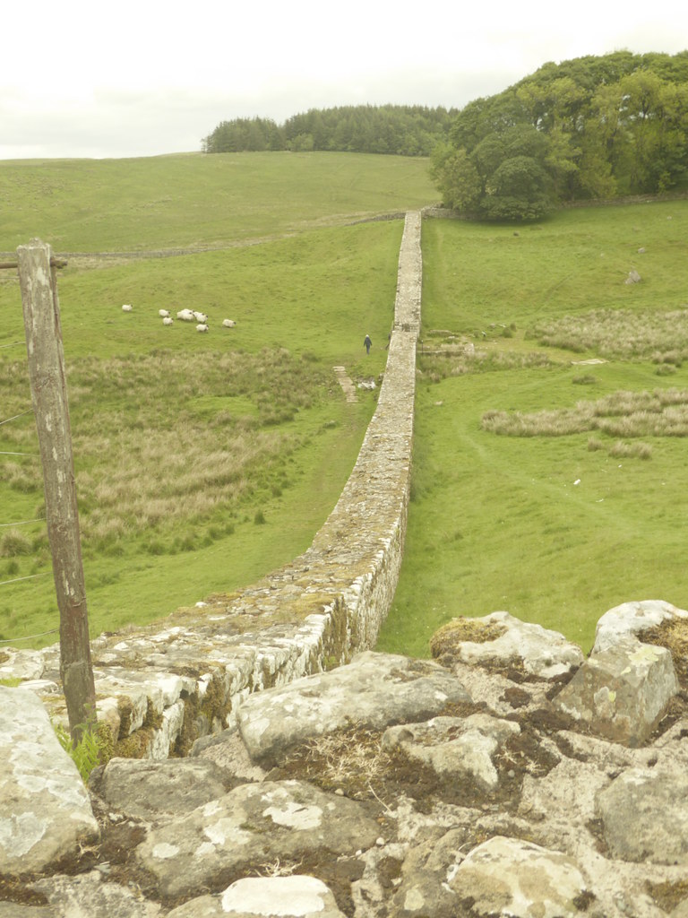
Let's first get a sense of the effect of the wall:

This work is licensed under a Creative Commons Attribution-NonCommercial-ShareAlike 4.0 International License.
For some reason, I've been fascinated with the history of the Romans in Britain. I've read novels and non-fiction about the topic, and visited what sites I could when my husband and I traveled in England. One of those sites is Hadrian's Wall, which stands out to me not only because of its impact, both visual and historical, but also because of my husband's lack of interest in touring it. Usually, he is great about accomodating our differing interests when traveling, and considering how many military museums, sites, and war cemeteries I've been too, that's appropriate. But I persevered. This post will blend sources with appropriate Creative Commons licenses with my reflections.
Let's first get a sense of the effect of the wall:
It is hard to imagine this knobbly spine of stones as the implacable barrier it once was. a structure two meters thick and five meters tall, manned by infantry....What can have been the effect on the Britons of this astonishing structure? This wall in the wilds of northern Britannia divides nowhere from nowhere. Visually, it makes about as much sense as Rene Magritte's open door suspended in a cloudscape.
(Charlotte Higgins, Under Another Sky: Journeys in Roman Britain, Overlook, 2015, pp. 112-113)
Here is some information about Hadrian's Wall, from Wikitravel, in case you would like to visit it:
Hadrian's Wall was built by the Romans to protect their colony in England from the Pictish tribes in Scotland. It stretches for 87 miles across the north of England from the Irish Sea to the North Sea in the counties of Cumbria, Northumberland and Tyne and Wear.
Built by Roman soldiers in the second century A.D., only stretches of the wall are still visible, but the wealth of archaeological research has resulted in an almost unparalleled cluster of museums and excavations.
==Cities & Towns==
All these towns are near to the Wall, but the Wall itself is strung out in the countryside.
==Understand==
Hadrian's Wall was one of Ancient Rome's fortified borders, which gave the late Roman Empire security against the barbarians at its gates. Constructed and later garrisoned by soldiers drawn from all over the Roman world, the wall preserves an immense amount of military and civilian day-to-day life.
==Get in==
By road (perhaps bus) from main roads or transport hubs at Carlisle or Newcastle. Part of the wall is also on the Pennine Way long-distance footpath.
==Get around==
There is now a recognised national path that follows (with slight deviation) the whole length of the wall from Wallsend to the Solway Firth. The path is relatively easy going for most of its route, with the notable exception of the middle section around Steel Rigg. Here the path rises and falls steeply as it follows the escarpment. This section is however regarded as the most beautiful.
==See==
There are excavated Roman forts at Vindolanda, Houseteads, and Chesters. Housesteads is the most famous and has the most complete ruins. Vindolanda features better reconstructions. Chesters has the best headquarters building and commandant's house. Each has a museum; the museum at Chesters has the widest range of artefacts from the excavations.
There are numerous smaller forts and milecastles, though many are little more than lumps in the ground. The small Temple of Mithras at Procolita is well worth seeing.
The museums are rounded out by the Roman Army Museum.
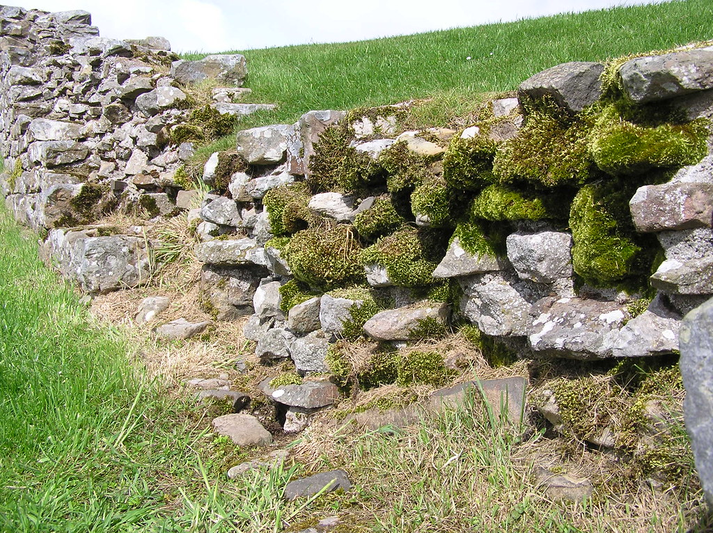
 |
| Housesteads section of the Wall |
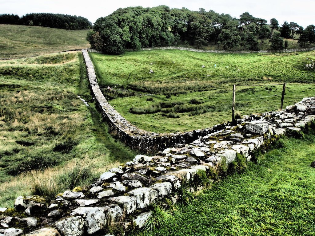
 |
| Housesteads |
 |
| Unknown Location on the Wall |
My derivative work:
 |
| Text added to photo: "02_2016-08-20_Hadrian32" by Ungry Young Man is licensed under CC BY 2.0 |
Part 2: Short Reflection
This was quite the learning experience! Although I knew in theory what I'd be doing, practice is a bit different. The post isn't nearly as attractive as I had hoped it would be. I wish I could have done a nicer section with the photos. My derivative work isn't very creative, but I am actually curious and so the question is appropriate. And I am not sure I labeled this derivative quite correctly. I had originally thought I might not need the share-alike part of the CC license, but a number of the photos I found included it, so I did as well, as required. This blog post does not meet the requirements of a free cultural work, I would have to remove the NC and SA limitations. I would not be able to do that given some of the items I have included.
As part of putting this post together, I found a typo in the Wikitravel content, so I had to sign up for an account there in order to fix it. Now that I've done that, perhaps I'll do more work on that platform. When I think about the process I needed to follow to create this, I really wonder how many of my students follow the same procedures, if they are creating such composite works.
This work is licensed under a Creative Commons Attribution-NonCommercial-ShareAlike 4.0 International License.

Comments
Post a Comment